

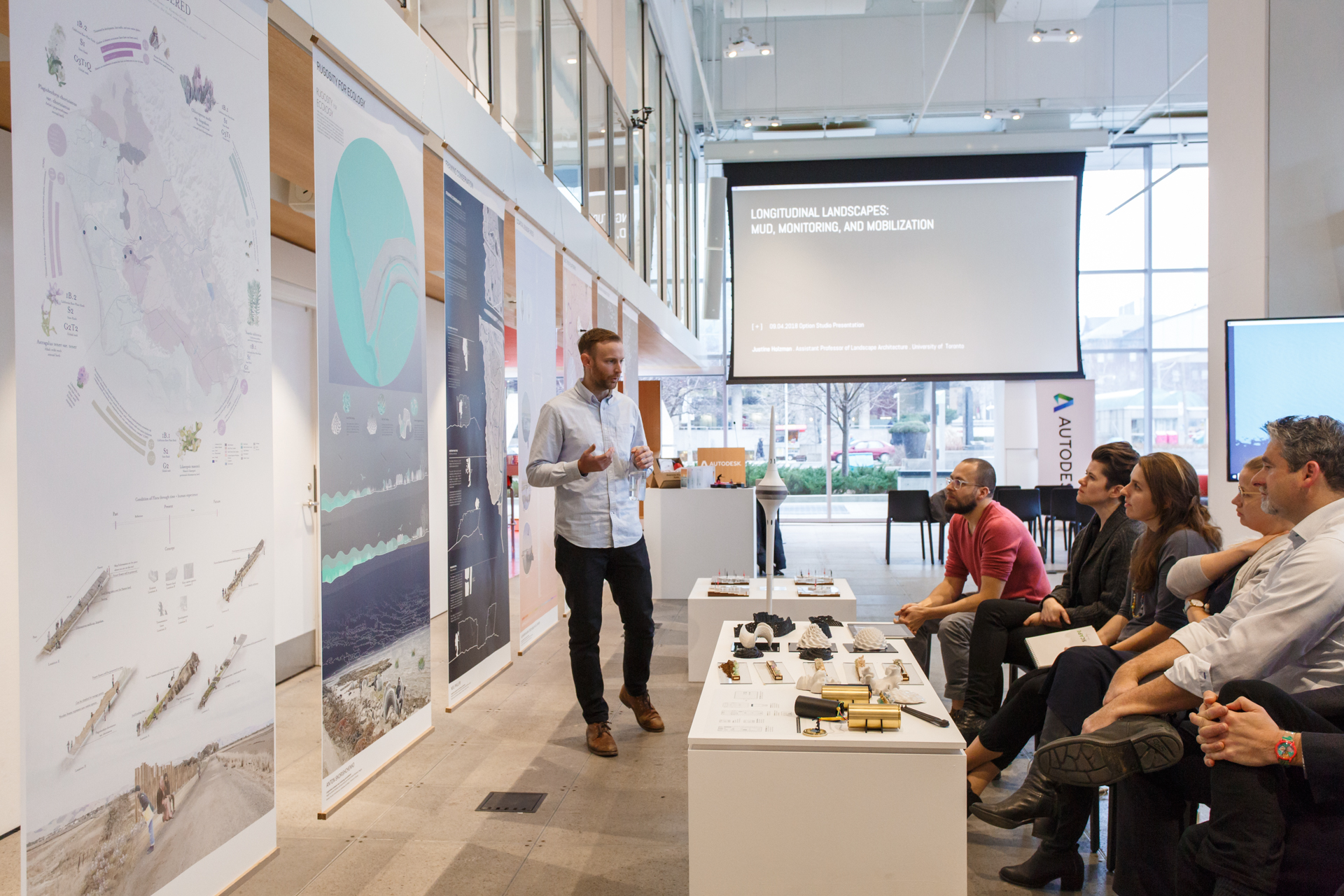
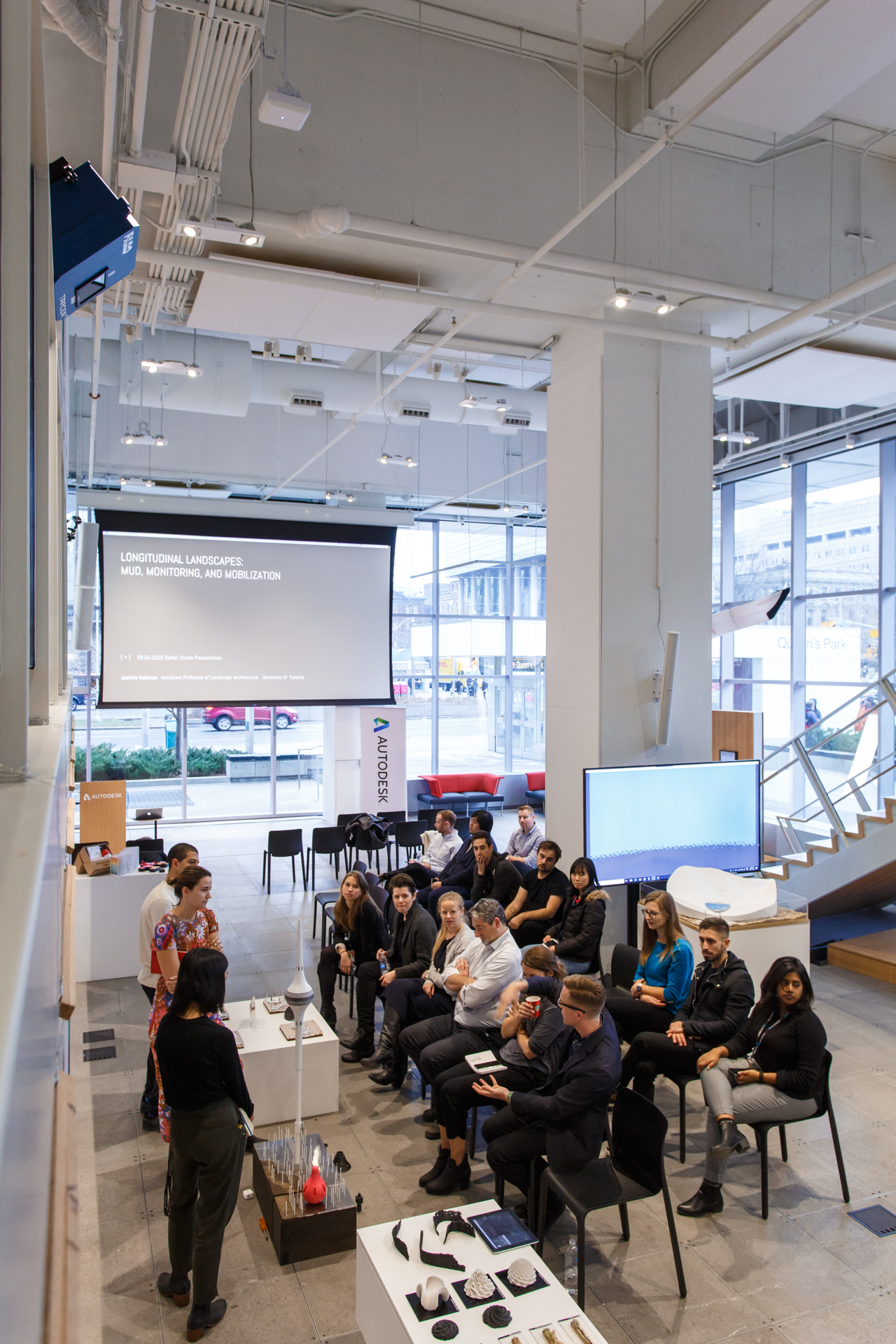
31.03.19 - Longitudinal landscapes: Mud, monitoring, and mobilization in the San Fransico Bay Area
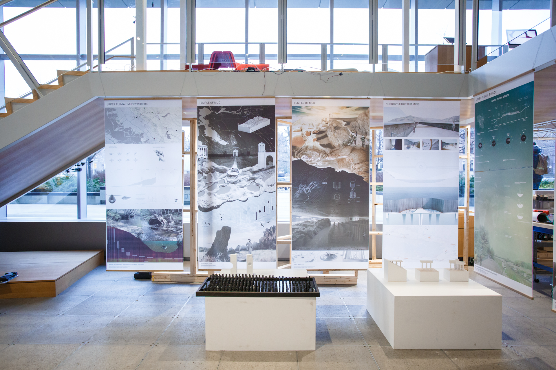
Last fall, students in Assistant Professor Justine Holzman's studio, Longitudinal Landscapes: Mud, Monitoring, and Mobilization, were residents at Autodesk in the MaRS Discovery District, working alongside designers and researchers at the forefront of their fields.
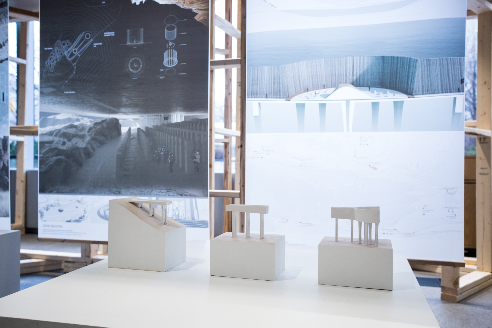
With graduate students in both architecture and landscape architecture, the option studio challenged students to develop design strategies that support revitalization of the San Fransico Bay Area's watershed: its tributaries, marshes, and mudflats — all of which host important ecologies, retain carbon, and have a role to play in protecting communities from risks associated with rising sea levels, unpredictable weather patterns, increased flooding, fires, and erosion. Autdoesk generously provided specialized software and fabrication training, access to advanced fabrication tools, and space for the students to prototype and develop their ideas.
The work of the students built on research and design initiated by the multidisciplinary design team Public Sediment, a participant in the Resilient by Design | Bay Area Challenge, held in 2017. Led by SCAPE Landscape Architecture studio, the team included members of the Dredge Research Collaborative, to which Holzman belongs. Gena Wirth, Partner and Principal of SCAPE Landscape Architecture and Cy Keener, Assistant Professor at the University of Maryland supported the students with design and technology workshops throughout the semester. The students also took a field trip to the Bay Area to explore the geography, conduct field work, meet with local stakeholders, and engage with members of the Public Sediment team.
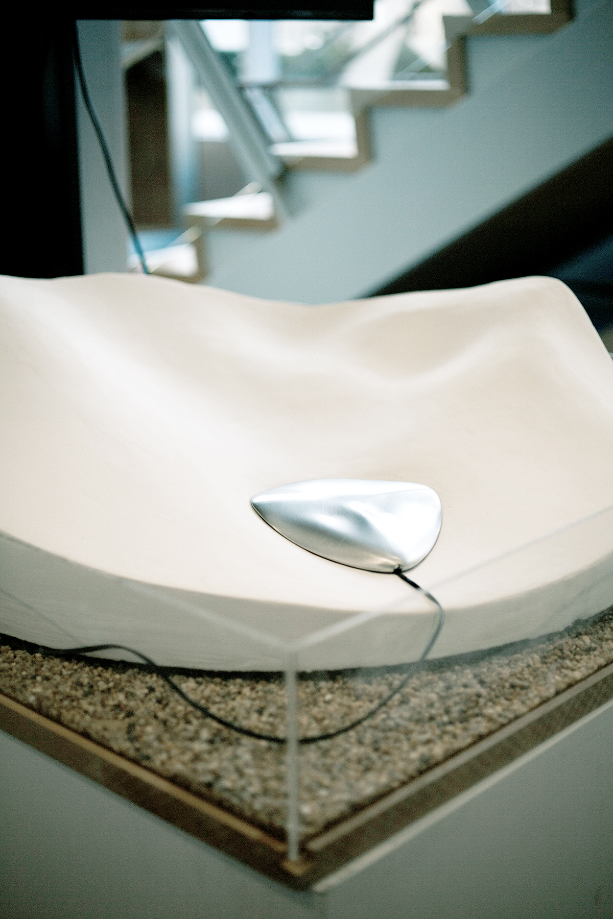
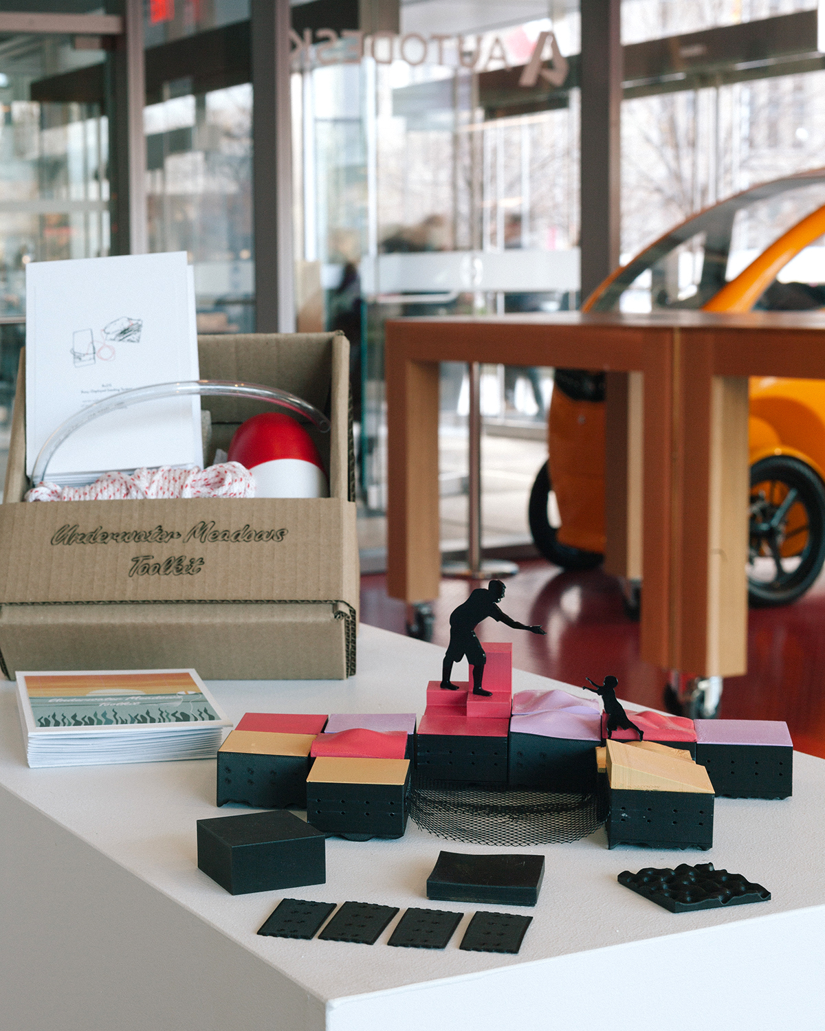
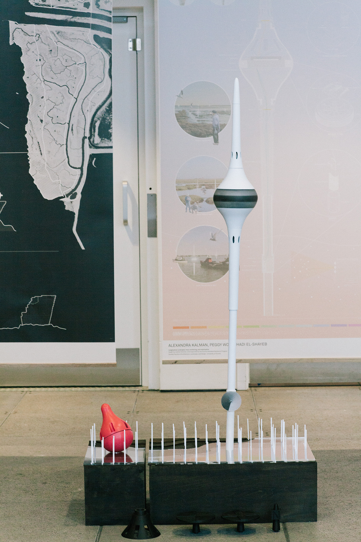
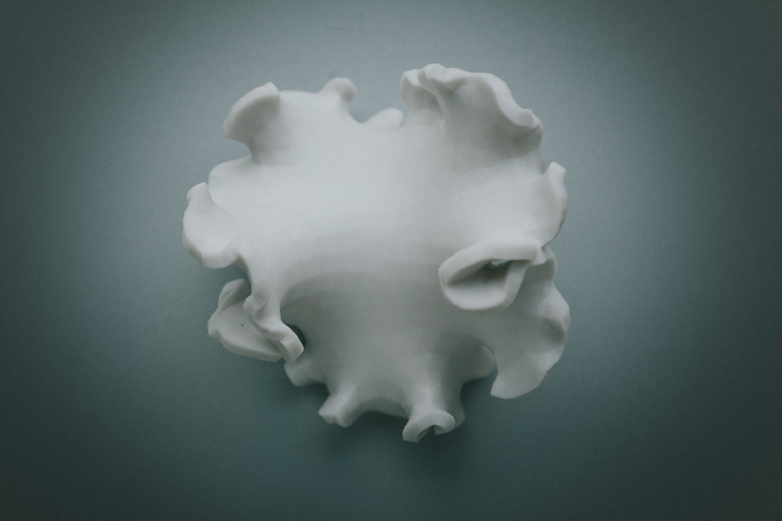

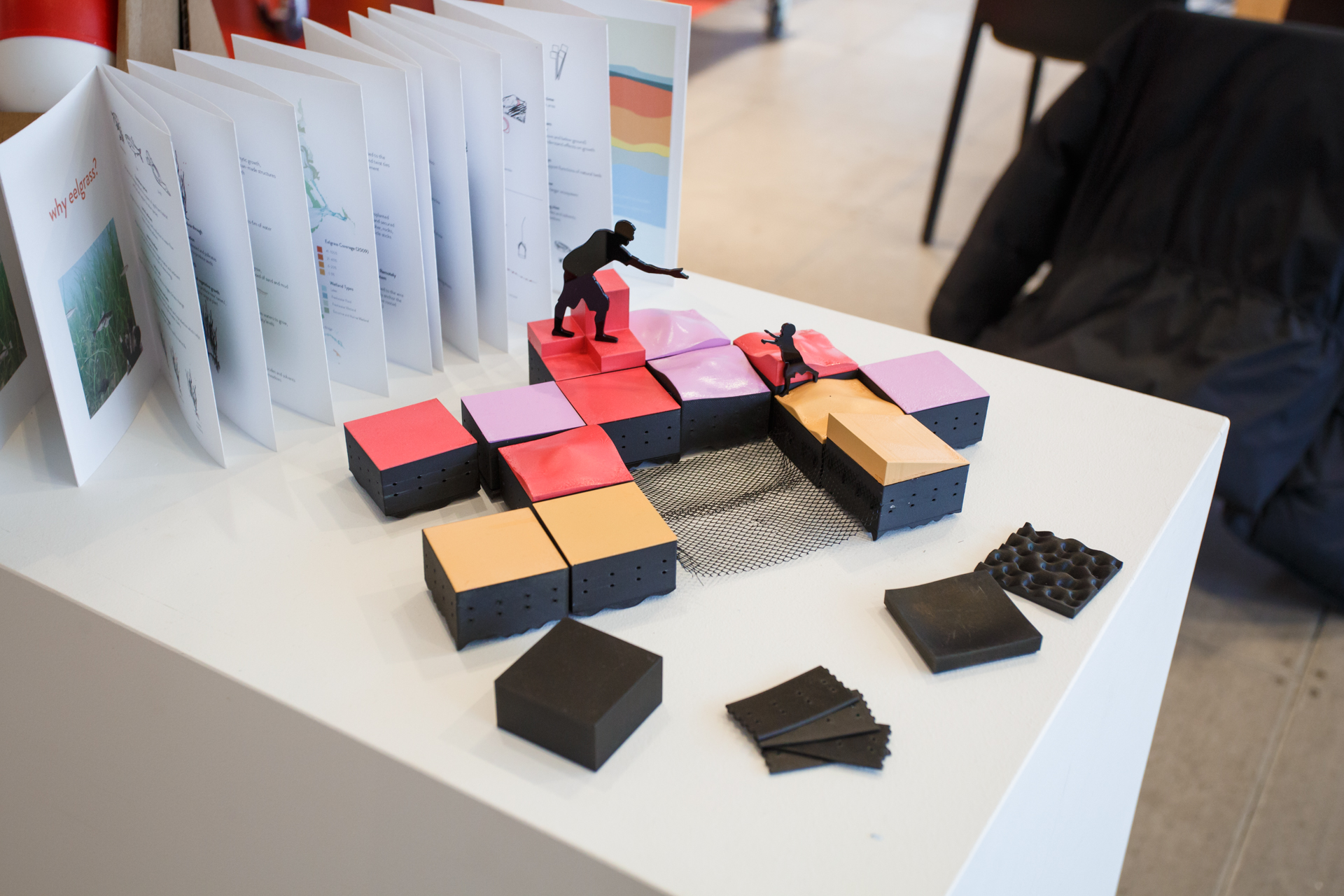
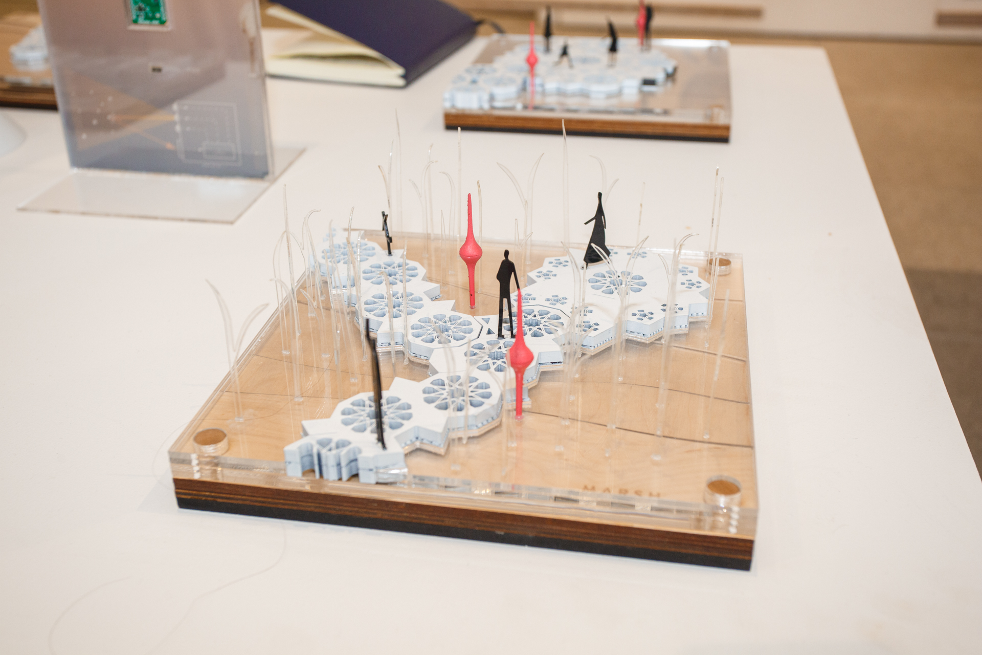
Above: 1) A hydrophone, designed to sense the sediment movement and load, inspired by singrays and horseshoe crabs, by Devin Tepleski, Aaron Hernandez, and John Nguyen; 2) a citizen tool kit for eel grass restoration and floating boardwalks would support these efforts, by Peggy Wong ; 3) a wand that measures turbidity, salinity, and temperature, by Lexi Kalman, Peggy Wong, and Hadi El-Shayeb; 4) part of a series of bio-inspired eco-concrete form that would hold sensors; 5) an electronic sensore that could measure temperature, salinity, and turbidity, by Neil Philips, Anton Skorishchenko, and Reesha Morar | Images above by Devin Tepleski; images top of page by Harry Choi
The students’ design projects were developed with the understanding that living systems require careful monitoring and adaptive management. With this in mind, they worked to produce site design strategies alongside monitoring infrastructure, such as prototypes for upland, fluvial, tidal, and coastal sensors. Together, they generated concepts that included "listening" to sediment, measuring salinity and turbidity (the amount of sediment in the water), floating boardwalks that support restoration efforts, and citizen ecological restoration tool kits.
The studio culminated in a public exhibition of student work at Autodesk’s Toronto Technology Centre. Students, faculty, and guest critics participated in an advanced discussion of how monitoring infrastructure can assist in the design, adaptive management, and understanding of urbanized coastal watersheds while providing opportunities to connect with the public and democratize data.
Students included: Aaron Hernandez, Anton Skorishchenko, Devin Tepleski, Hadi El-Shayeb, John Nguyen, Krystal Kramer, Lexi Kalman, Neil Philips, Peggy Wong, Resa Morar, Shujie Zhang, and Vinaya Mani.
For more information: