

31.05.21 - Landscape students creatively reinterpret famous forts and tumuli
In Visual Communication 2 (LAN1022), a course taught by assistant professor Fadi Masoud, first-year Master of Landscape Architecture students develop their drawing and visual representation skills by each studying either a colonial fort or an Indigenous burial mound (known as a tumulus). Students draw the topography of their assigned sites, but the work doesn't stop there. The course calls upon them to develop fictional narratives about their forts or tumuli, then illustrate those narratives in ways that show off different atmospheric conditions.
This year's projects can all be viewed in their entirety on the new Forts and Tumuli website. Below, a few highlights.
Emiley Switzer-Martell
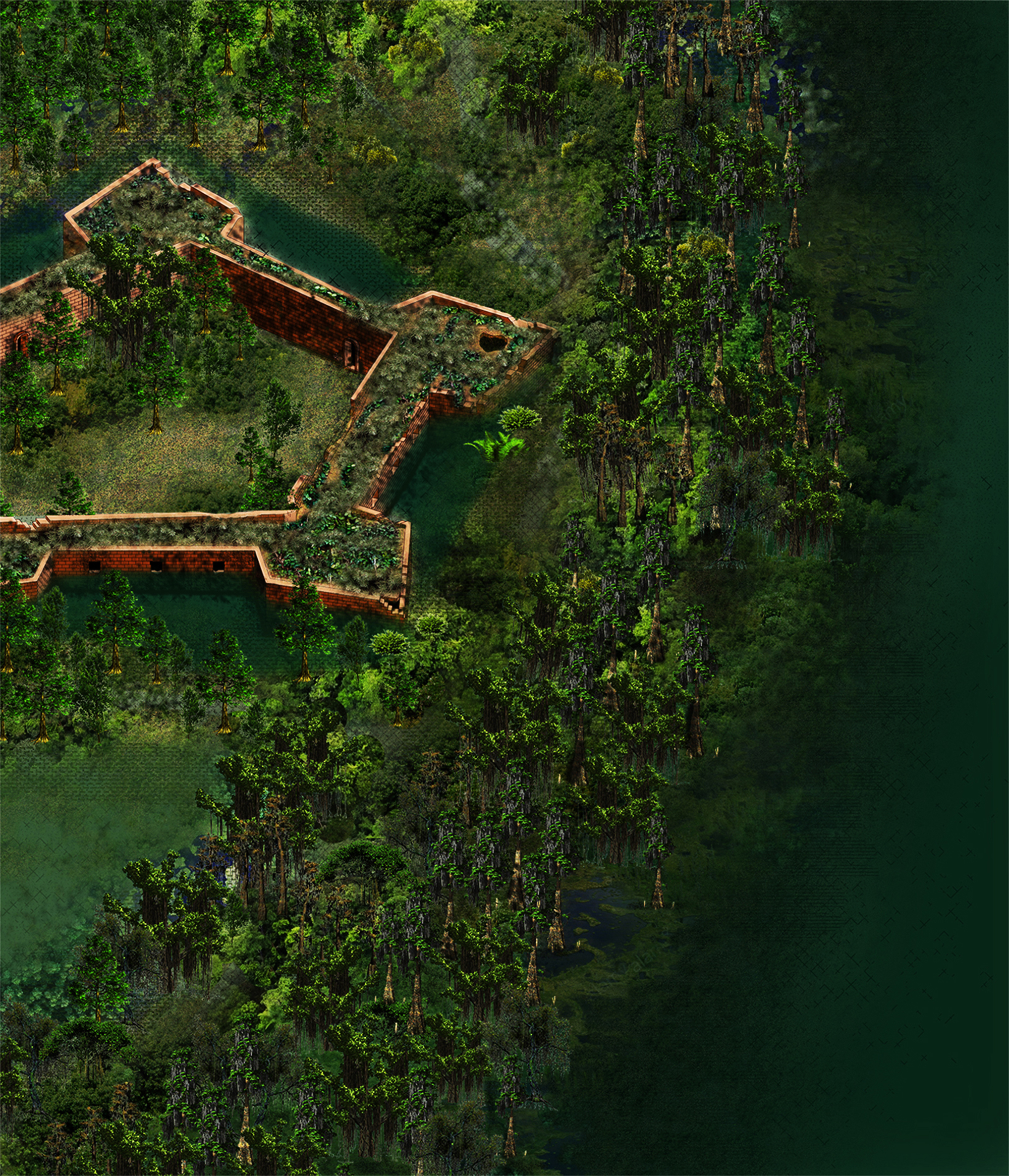
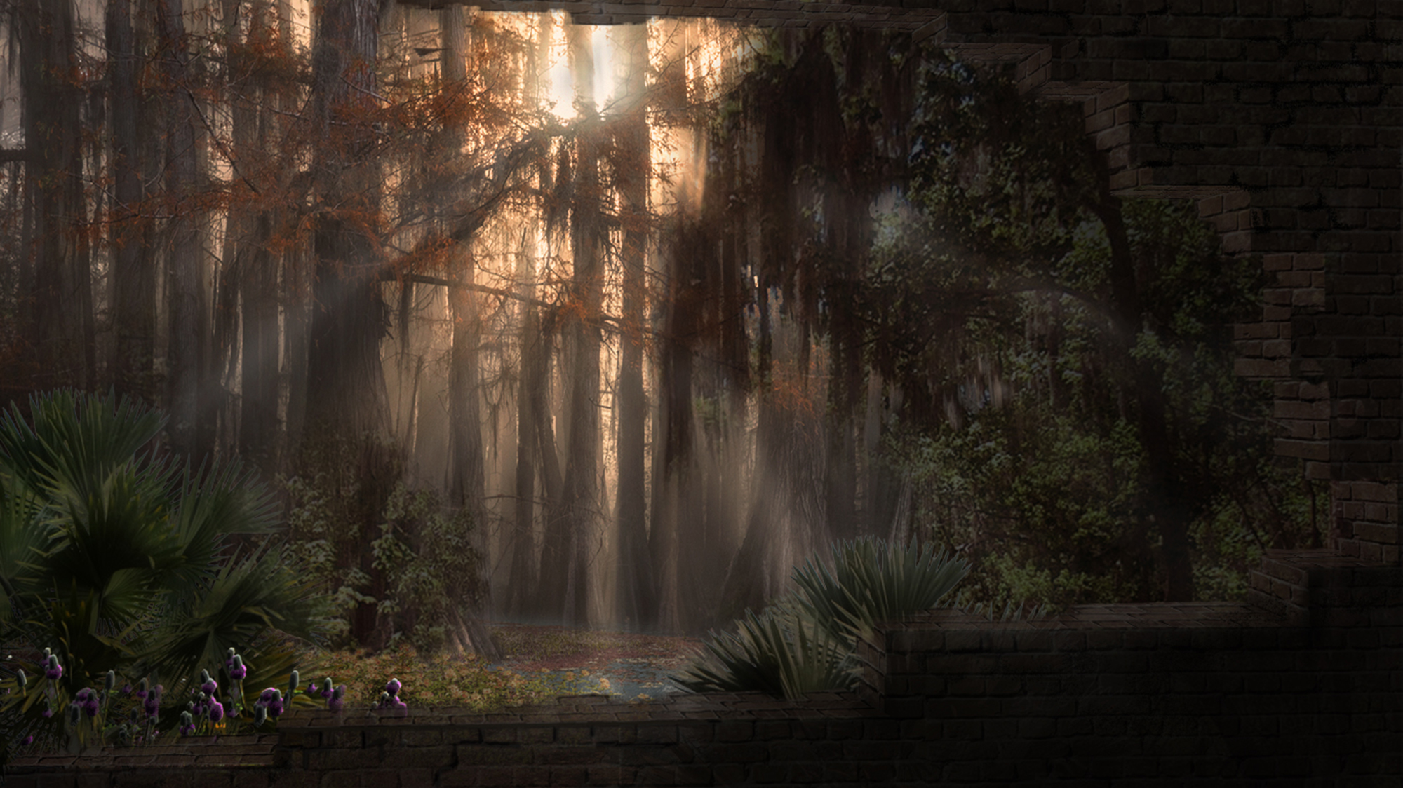
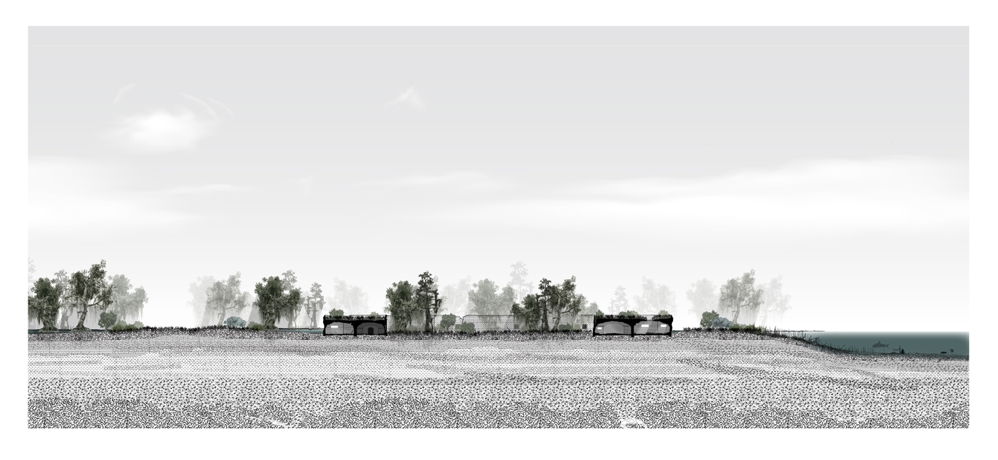
Emiley's site was Fort Jackson, a 19th-century fort located near the mouth of the Mississippi River, in southern Louisiana. Emiley imagined a future when climate change has caused the area around the Mississippi River delta to be abandoned by humans, who can no longer live with the region's frequent storms and flooding. The nearby forests have reverted to an almost primeval state. The drawings show a young girl, one of the area's last inhabitants, wandering the terrain. Emiley studied native vegetation in order to add some verisimilitude to the presentation.
Kiran Khurana
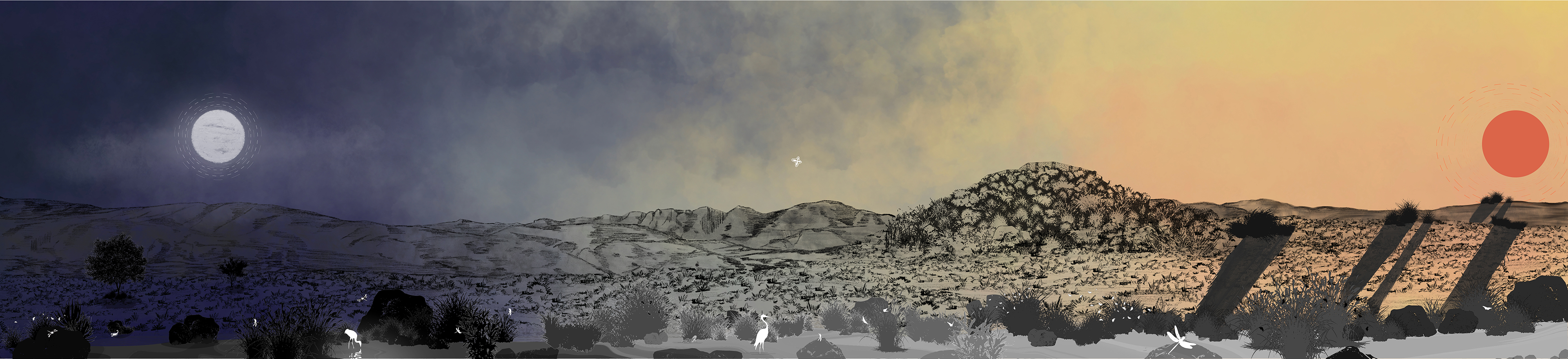
Kiran studied Tuzigoot National Monument, an Arizona archaeological site that includes the ruins of a Sinagua pueblo. Visitors to the site can tour the remains of a 110-room village that is believed to have been abandoned centuries before the first European settlers arrived in the Americas. In her research, Kiran discovered that the monument is now an important site for birdwatching. Her drawings show the site transformed into a reserve for those birds. She created a haunting, lonely atmosphere by drawing vast, colourful horizons by hand.
Benson Zou
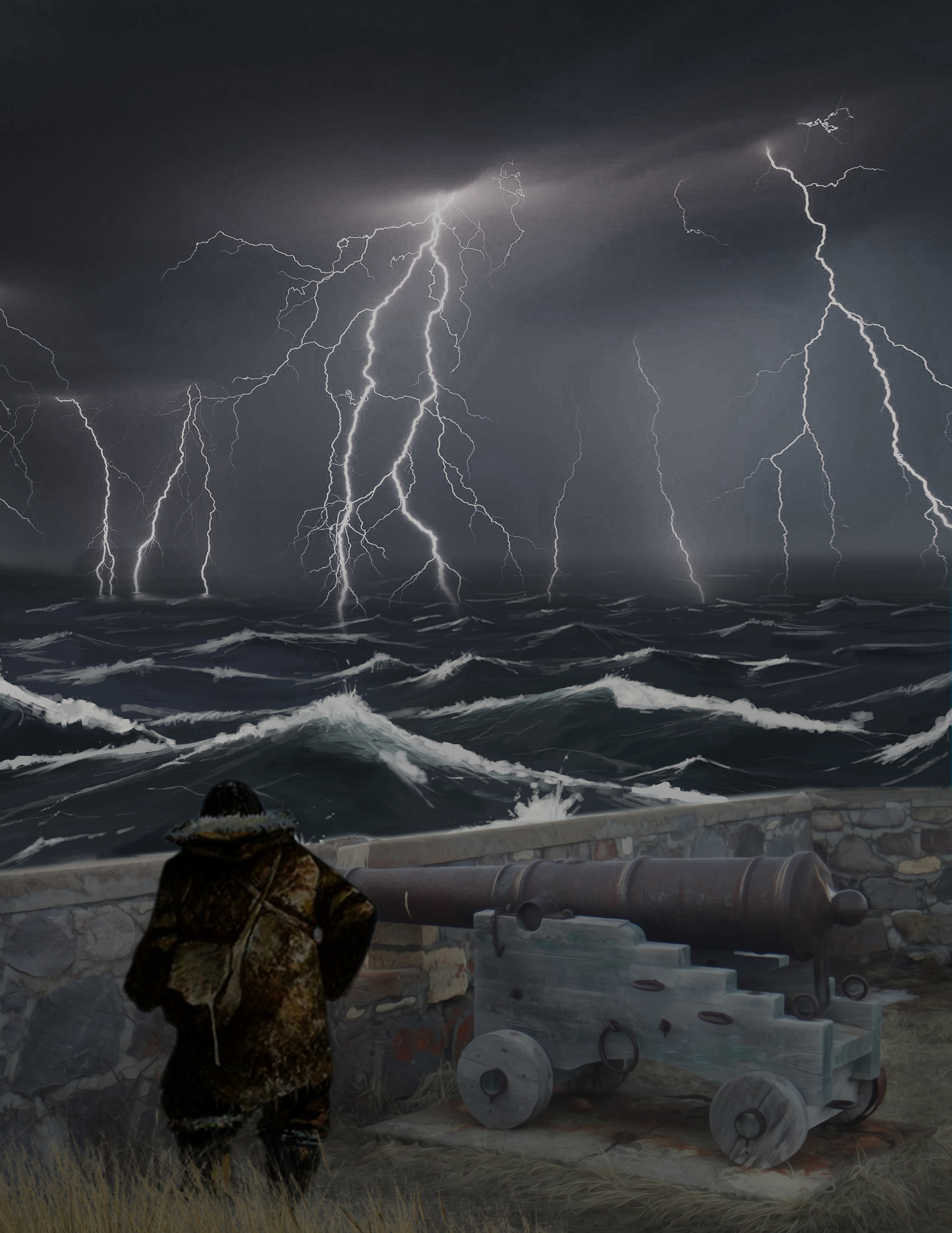
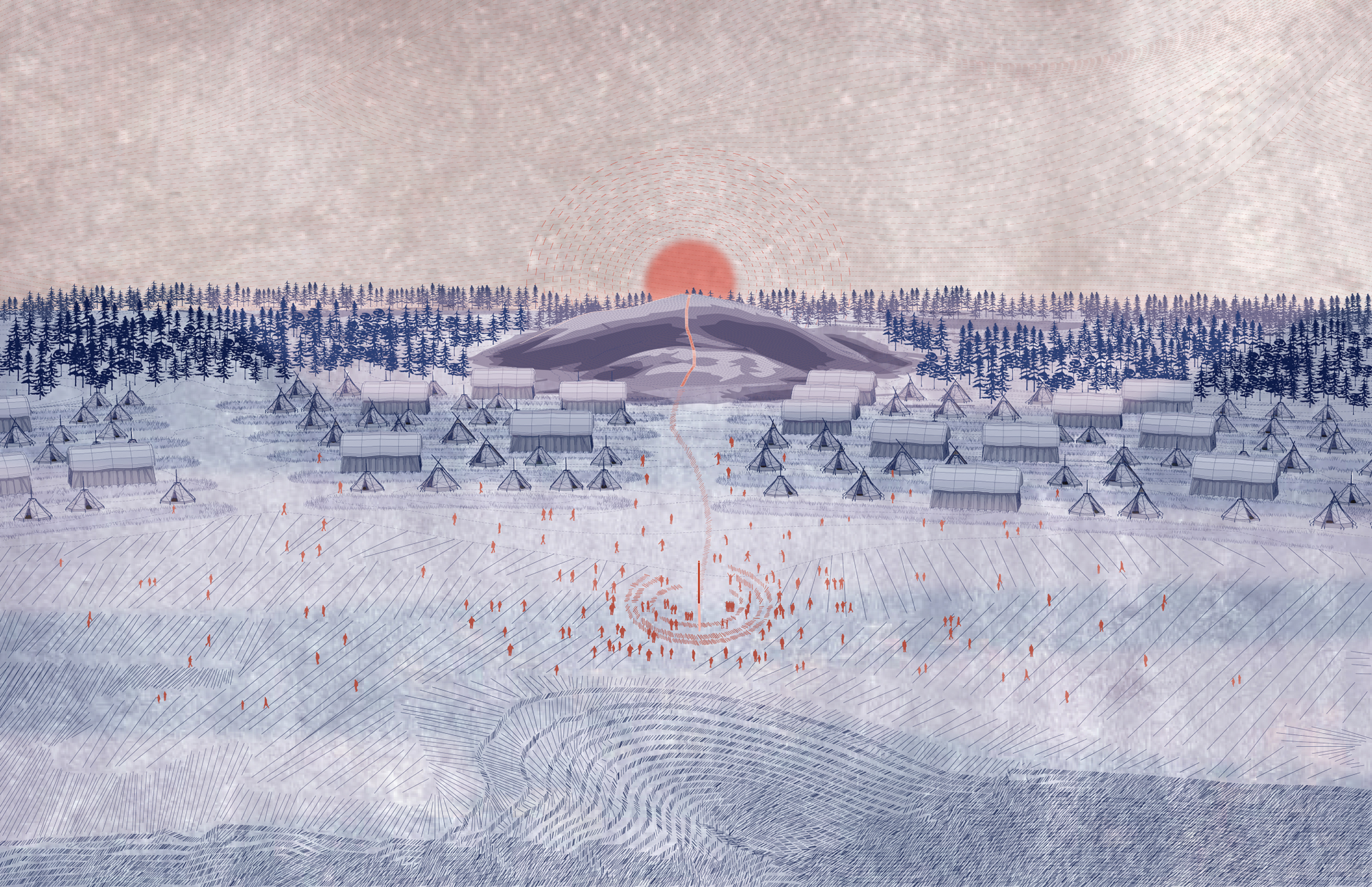
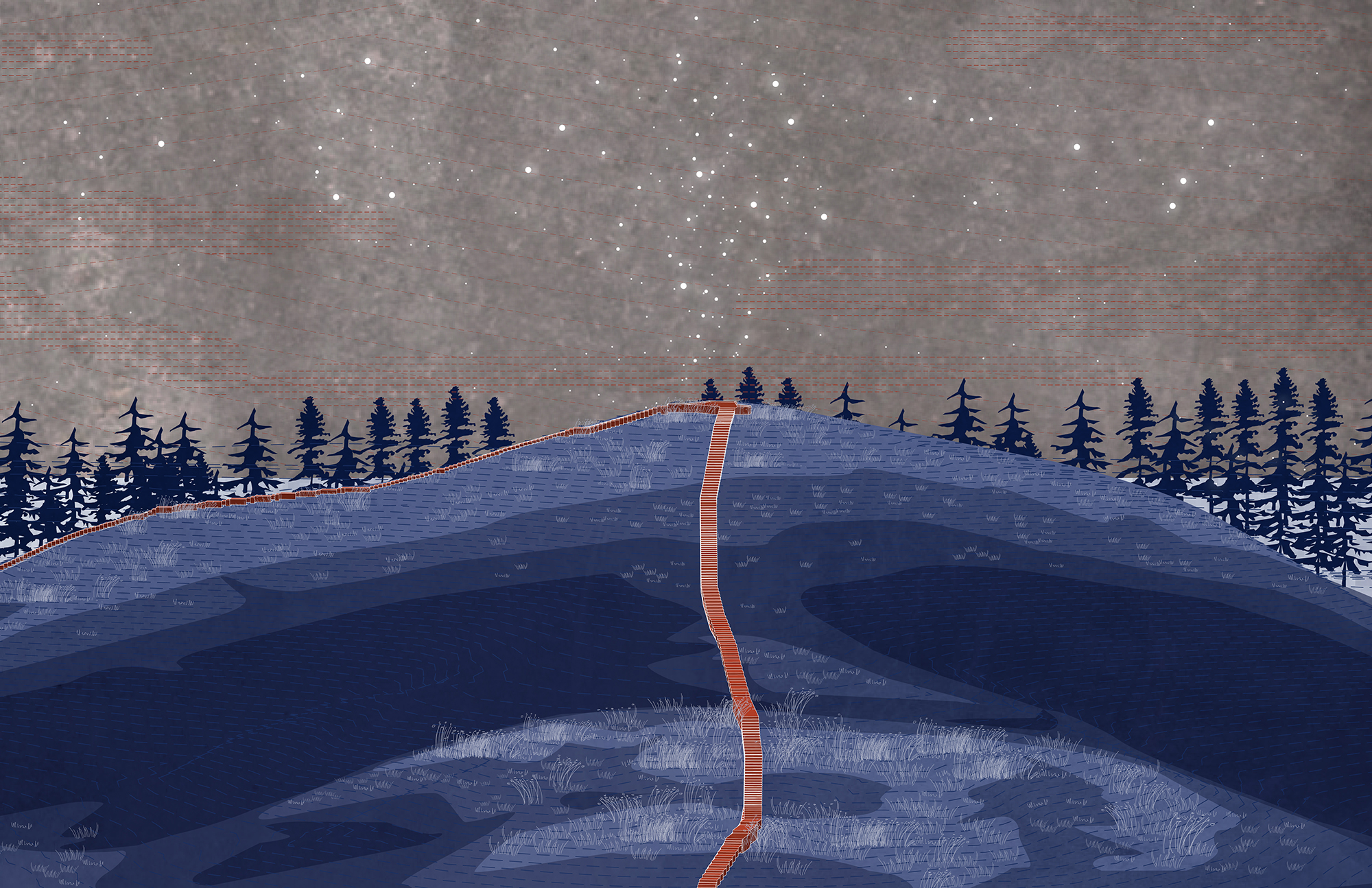
Benson chose the Prince of Wales Fort, an 18th-century fort in northern Manitoba, originally built by the Hudson's Bay Company to help secure the local fur trade. The fort was handily captured by three French ships in 1782. "It's this majestic looking fortress, but it was actually really easy to take over," Benson says. His drawings reimagine that event from the perspective of an Inuit child who has a premonition of the ships' arrival in a dream. Benson studied paintings of Inuit communities to help him render the scene.
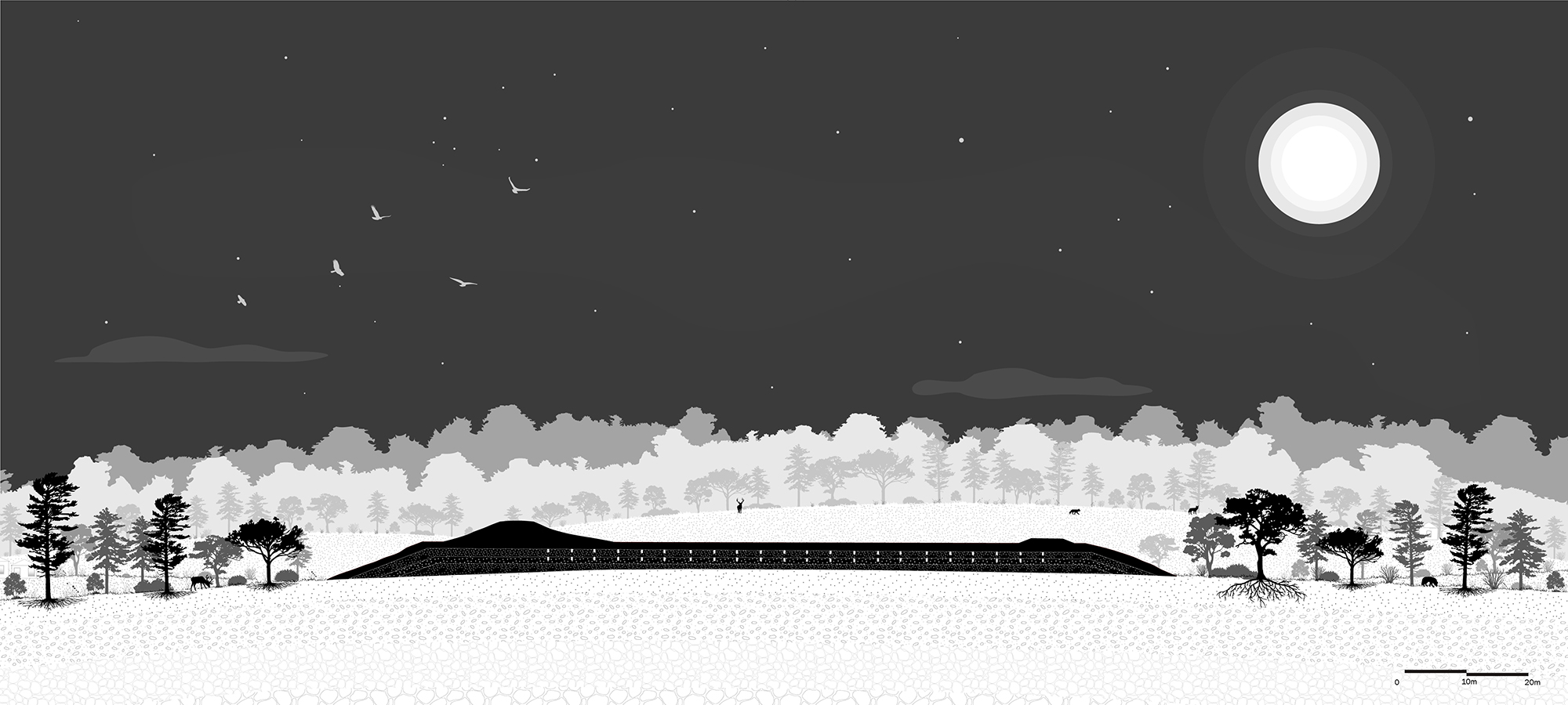
Ying Zheng
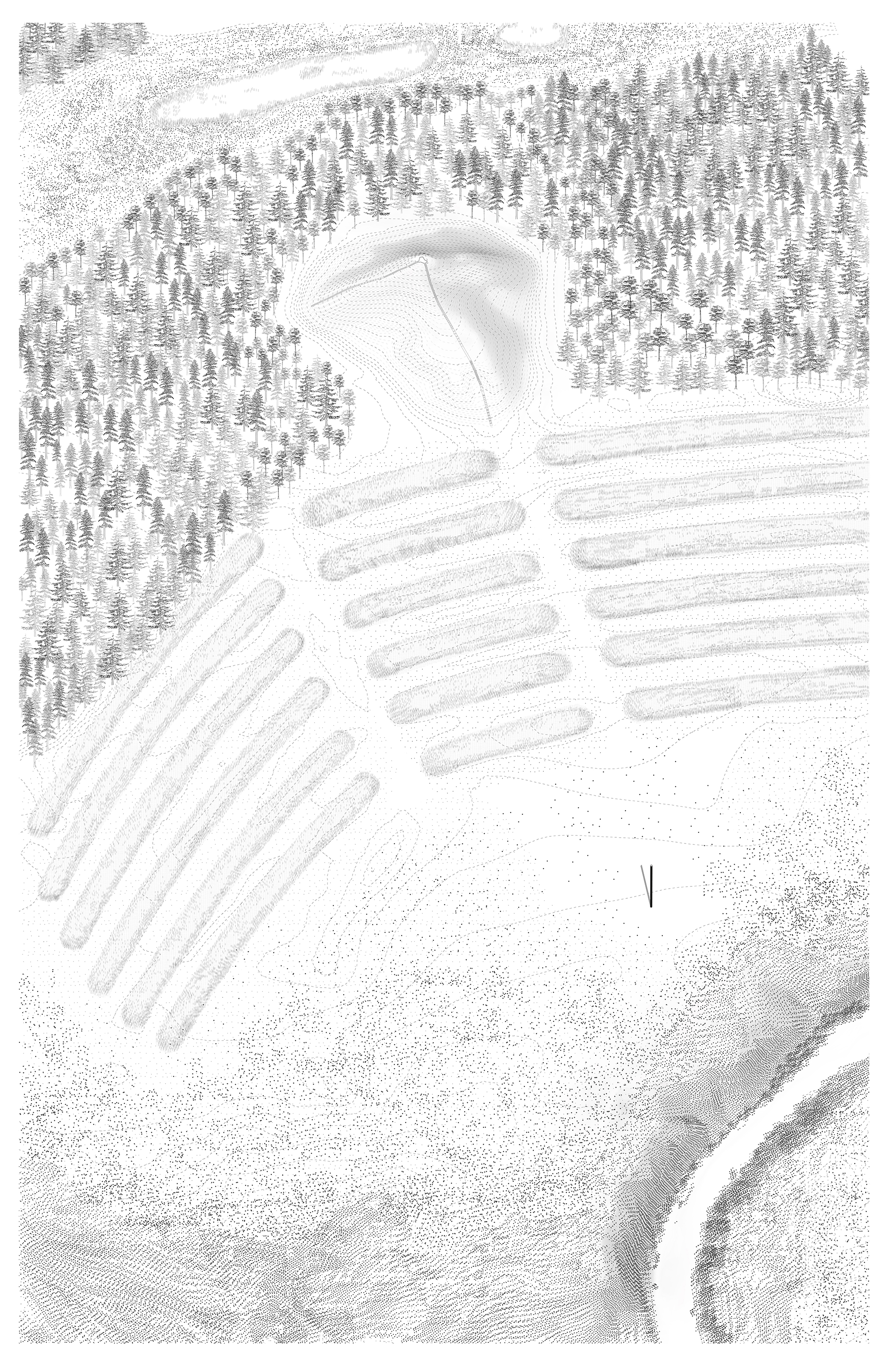
Ying's project dealt with Poverty Point, a Louisiana historical site that includes the remains of an ancient Indigenous settlement. The major features of the site are a set of C-shaped ridges and earthen mounds, all of unknown purpose. Yue invented a world in which the residents of modern cities abandon their urban homes and repopulate Poverty Point, so that they can revive the nomadic lifestyle of the site's original inhabitants. Her perspective drawings use a dreamy, ink-drawing style to convey Poverty Point's mysterious nature.
Luis Bendezu
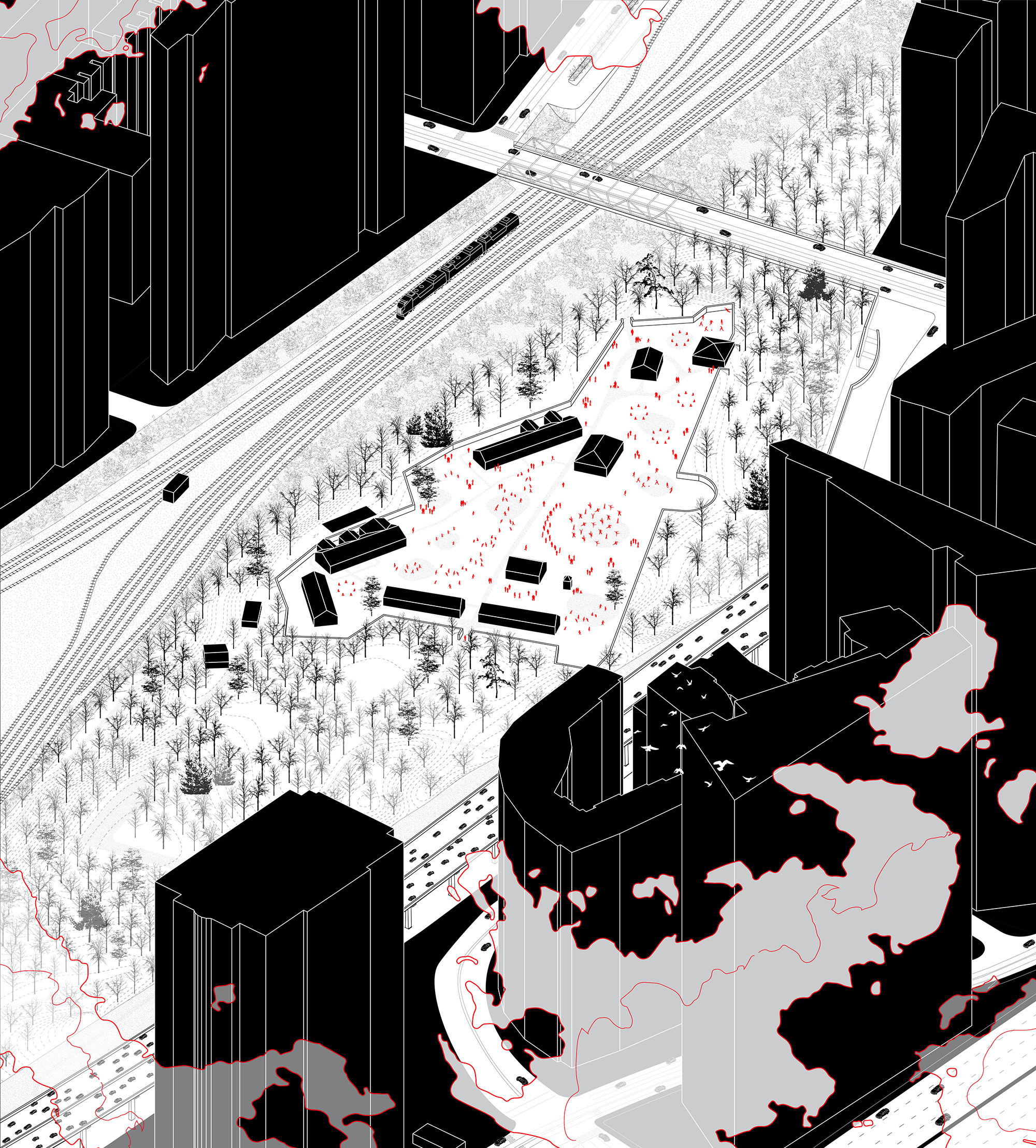
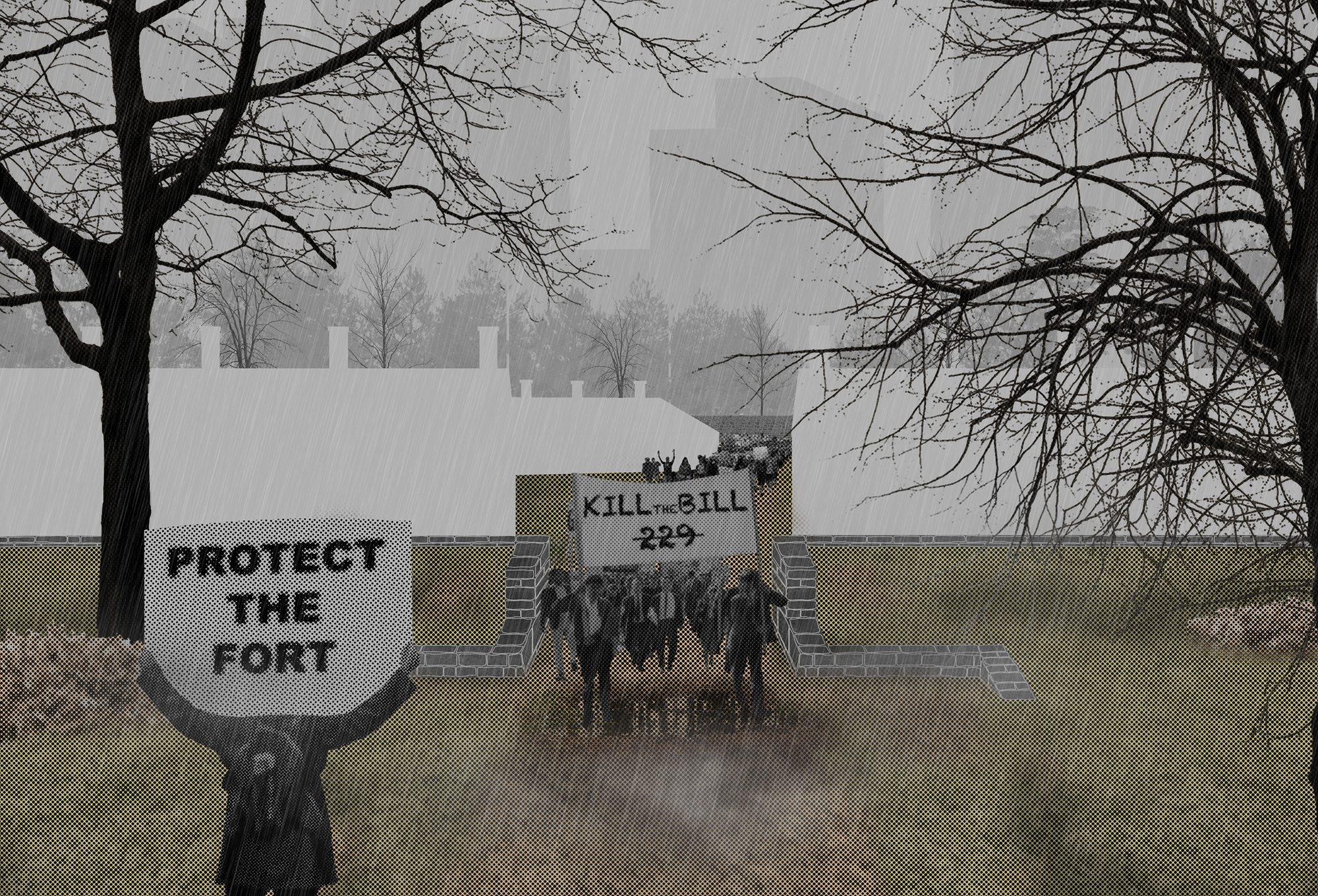
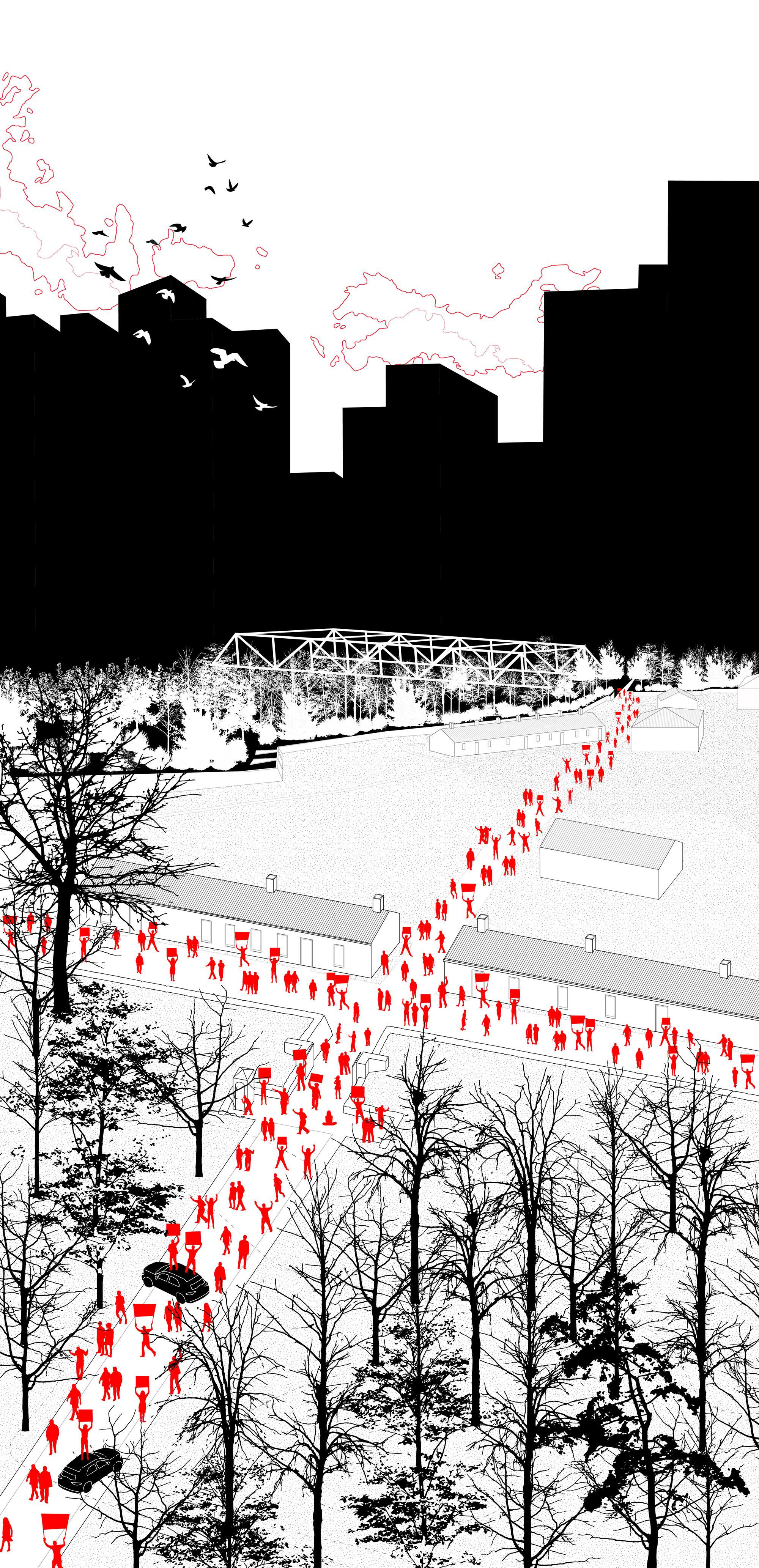
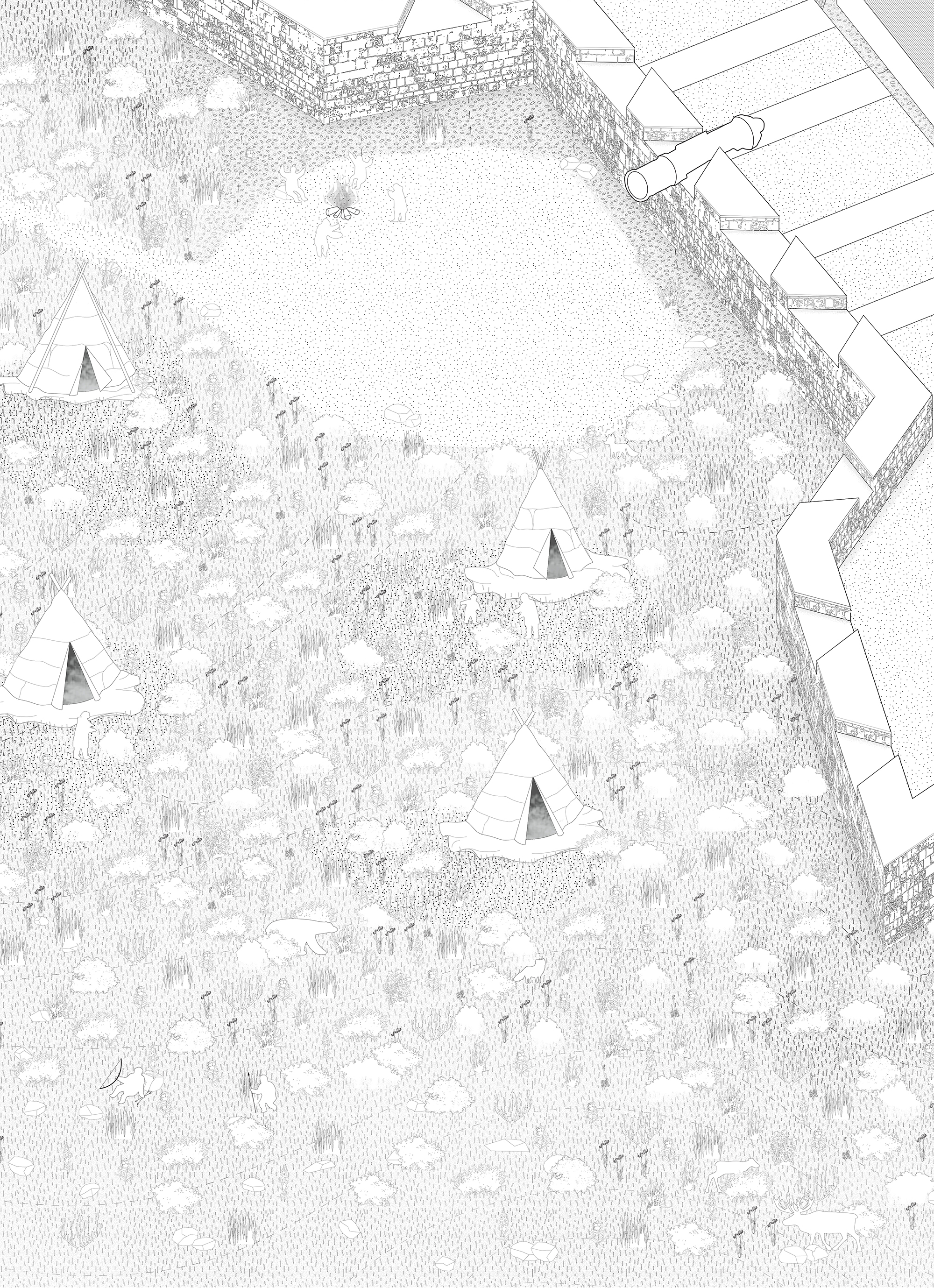
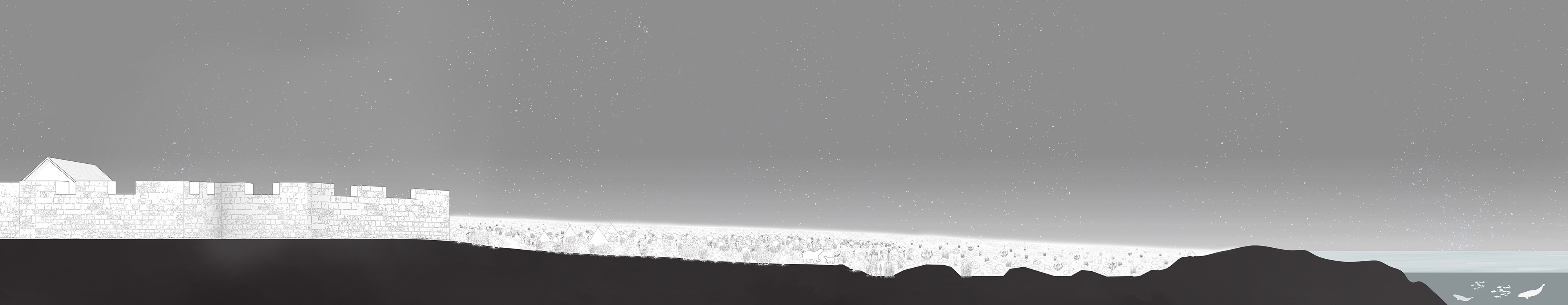
Luis's location is a familiar one to any Toronto dweller: it's Fort York, a colonial-era fortification that still exists as a historic site amid a dense high-rise community to the west of the city's downtown core. As Luis researched the area, he took notice of the controversy surrounding Bill 229, a new piece of provincial legislation, enacted under the auspices of pandemic relief, that weakens the ability of local conservation authorities to block land development. Luis's drawings illustrate a dystopian future where runaway construction has caused Toronto to become overrun with tall towers, leaving Fort York as the last remaining place where Bill 229's opponents can gather and protest. His drawings use a high-contrast colour palette, inspired by comic book art, to highlight the divide between built and unbuilt space.
Yue Wang
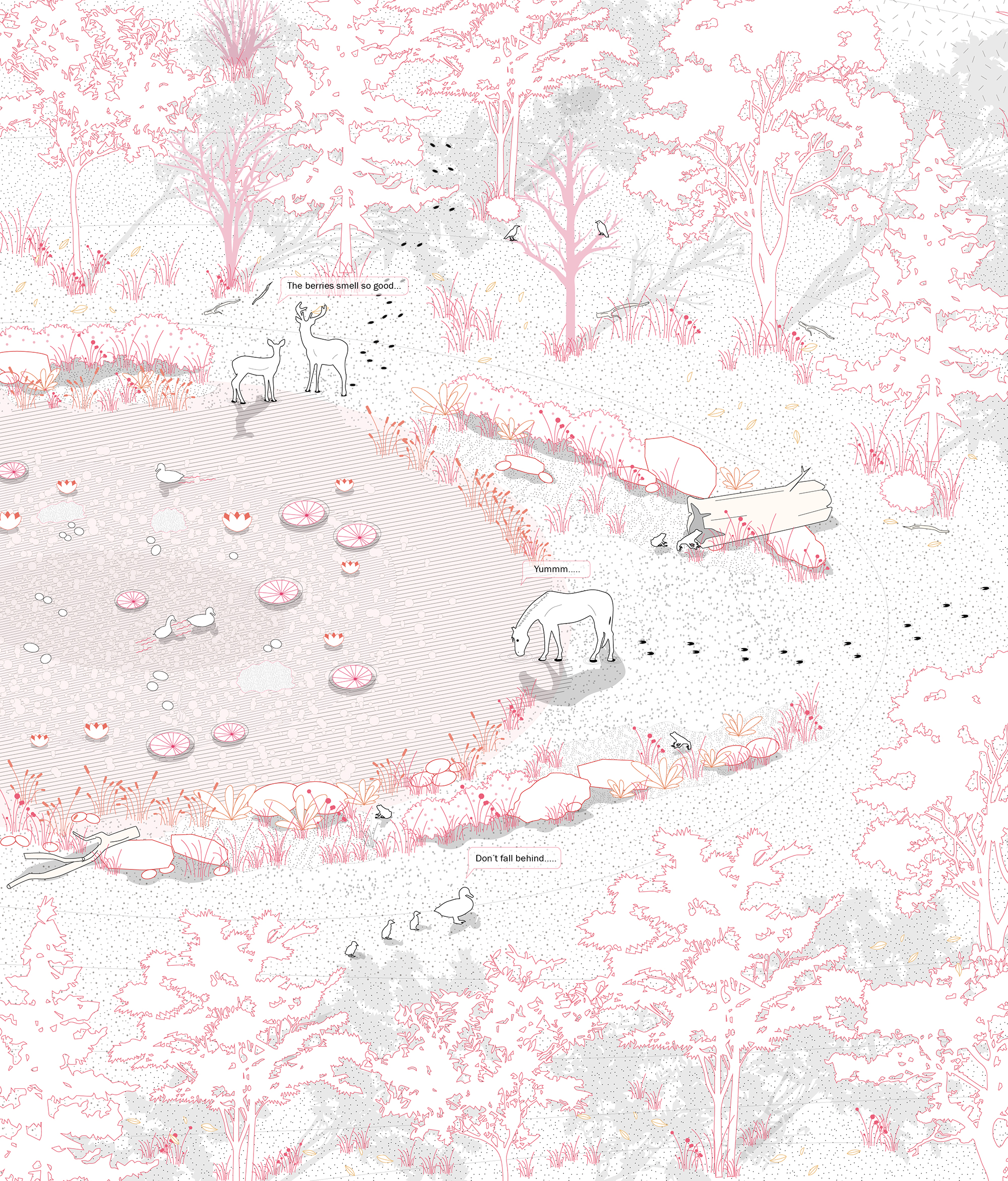
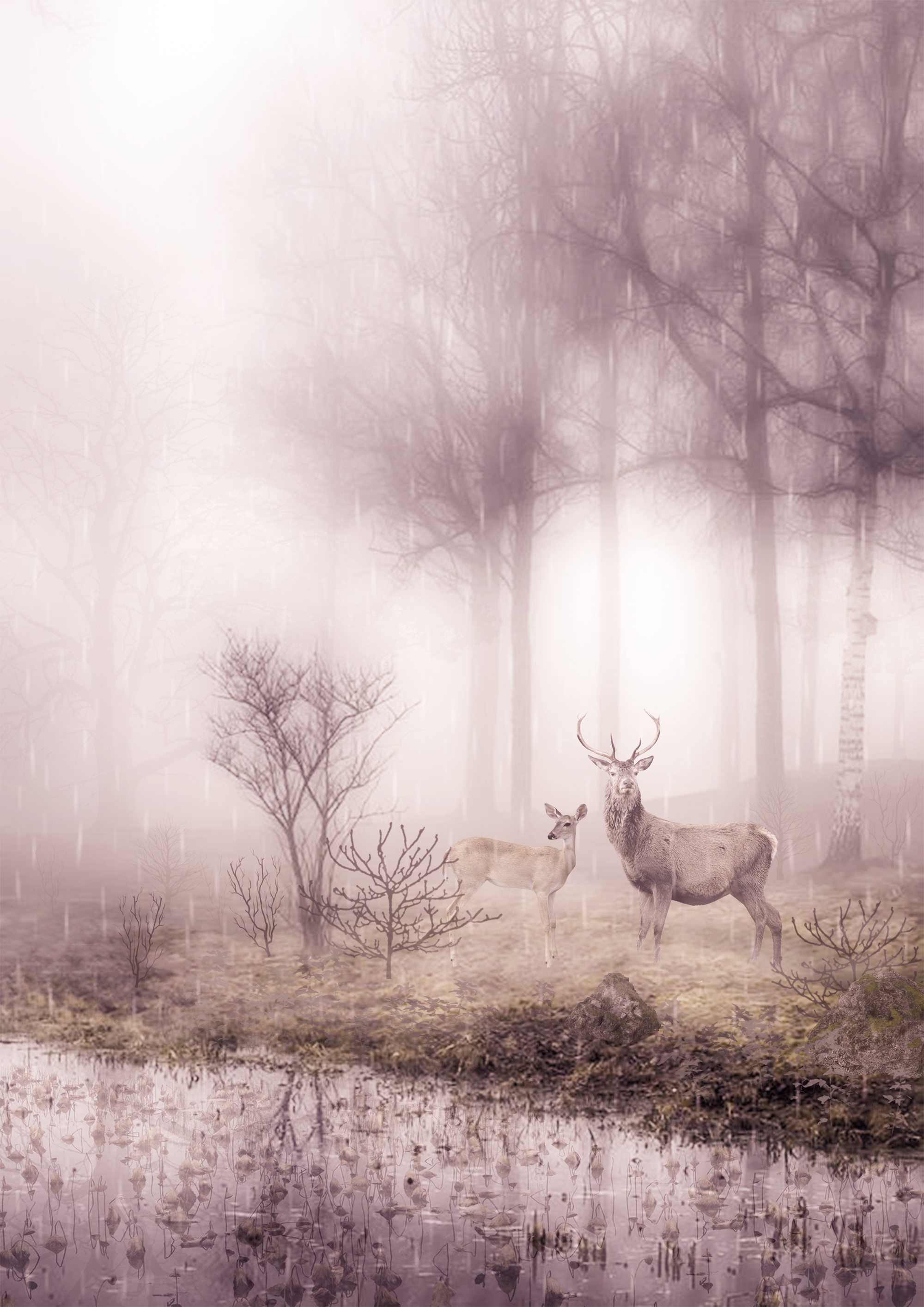
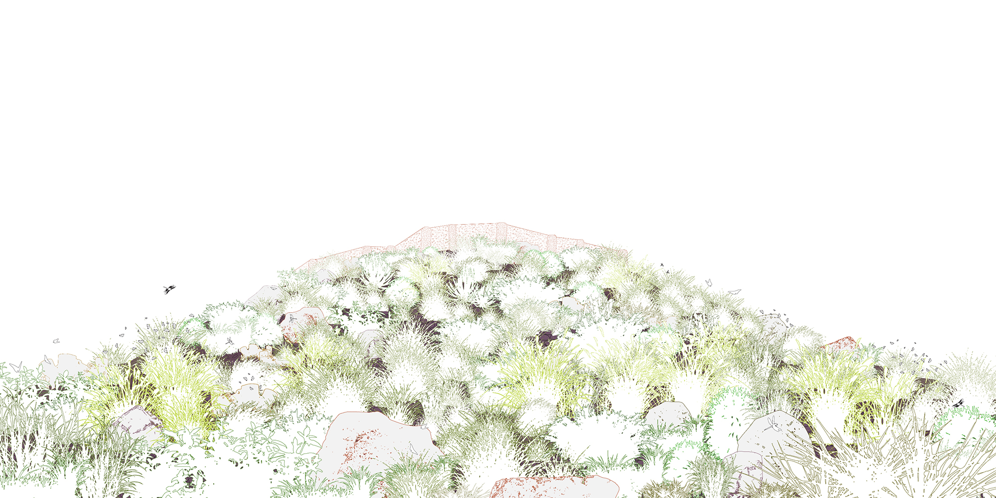
Yue studied the Emerald Mound Site, a location in southwestern Mississippi where a few mounds, believed to have been built by Plaquemine Mississippian people between 500 and 1,000 years ago, are preserved. Yue's images attempt to reconstruct what the site might have looked like after the original mound structures fell to ruin, but before the site's Indigenous inhabitants left the area for good. Her axonometric drawings show an Indigenous community living in harmony with local flora and fauna, beside the mounds. Her perspective renderings each highlight a different kind of local wildlife.